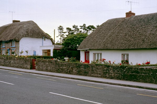
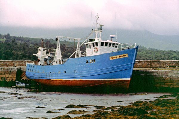
[1-8-1985]
Foto: Adare.
Uit de reisbeschrijving van Frames National:
Now we travel into the far south west of the country to the lovely counties of Limerick and Kerry with their scenic lakes and mountains.
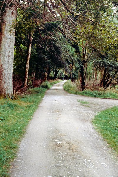
First from Limerick we travel through Adare, a picturesque thatched village set among green hills and woods which could well be in England. lt was built in the early 19th century and consists of one wide main street with medieval style cottages. The Normans built a castle here in the 13th century and a Franciscan Friary was established in the mid 15th century. Next lies Rathkeale, a small town whose wall of houses is split by a skyscraper high church spire. The district around is known as the Palatine and was settled by Lutheran refugees expelled by the French in the 18th century.
Newcastle West is a bustling market town along the River Dee in the heart of rich dairy land. The Castle was built for the Knights Templar in 1184. Passing through Abbeyfeale we reach Castleisland, a small market town built of blush red marble around a ruined 13th century Castle, and then Farranfore before entering Killarney.
[1-8-1985]
Uit de reisbeschrijving van Frames National:
Set amidst a stunning backdrop of soaring mountains, mist-shrouded lakes and gushing rivers. Killarney, a thriving town, has a notable cathedral regarded as the finest creation of the 19th century architect, Pugin. There are superb views across the three lakes; Lough Leane, or the Lower Lake, is the largest and is studded with islands; among them is Thomas Moore’s ‘Innisfallen’ with its ancient abbey. No small share of the beauty of Killarney is contributed by the range of hills known as MacGillicuddy’s Reeks which lie to the south-west of the lakes, stretching across the Iveragh Peninsula. Among them is the highest peak in Ireland, the 3,400 ft. Carrantual. To the west of the three lakes are the Tomies and the Purple Mountains separated by the Gap of Dunloe from the Reeks. Dunloe Castle ¡s a modernised dwelling but its walls are part of the old stronghold erected in the 13th century by O’Sullivan More to defend the entrance to the Gap. Nearby is Kate Kearney’s cottage.
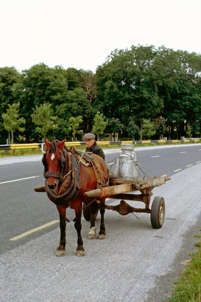
We follow the coast road around the main Kerry Peninsula, nearly 100 miles in length, providing wonderful views of Dingle Bay, the Kenmare River and Valentia Island. We pass by Lough Leane, to begin at Killorglin (Orgla’s Church) — just south of Castlemaine Harbour, on the River Laune noted for its salmon-fishing. It owes its fame to the 3-day Puck Fair, held August 10 to 12 by far the best known of its kind in Ireland. The livestock fair is watched over by a large puck goat set on a platform for the period. Fine views can be had of McGillycuddy’s Reeks to the south.
Onto Glenbeigh (Valley of River Beigh)— a delightful, small fishing and bathing resort, with the 2-mile long Strand to the north. The road from here to Kells (west), gives superb views of Dingle Bay with the tall mountains in the background.
We continue through Kells to Cahirciveen (Little Sadhbh’s Stone Fort) — Occupies a fine situation on the estuary of the Valentia River, with good little shops and quaint houses. Daniel O’Connor was born in Carhan House, just off the road as we approach the town. Some 11 miles further on we reach Waterville (The Little Whirlpool) — A sportsman’s paradise, with a fine, famous golf course. Shooting is popular here (whether you condone it or not) as there are lots of grouse, snipe, duck and plover in the woods around. The sea and mountain air is bracing here, and there is much of interest to the artist or archaeologist.
Van deze Ring of Kerry heb ik nauwelijks foto's en ook weinig herinnering omdat vrijwel alle spectaculaire delen in mist waren gehuld waardoor alle uitzichten eigenlijk ontbraken.
[1-8-1985]
Uit de reisbeschrijving van Frames National:
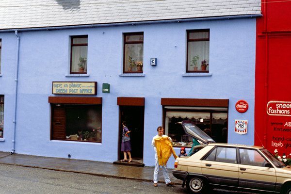
By Lough Currane to reach the Kenmore Estuary, then curling round the tip of the peninsula to Sneem (The Knot) — A village surrounded by fine mountain scenery, on the river Sneem. The Catholic Church here contains the grave of Father Michael Walsh, the original of ‘Father O’Flynn’ of the celebrated song. The Protestant church has a weather-vane in the shape of a salmon, probably of Elizabethan origin.
Close by lies Parknasilla (Willow Field) — A beauty spot of the first rank. The combination of sea, island, wood and mountain make this an idyllic spot. The climate is notably mild, and palm trees grow in some of the charming private and public gardens. Winding paths, rustic bridges, sparkling sea-creeks overlooking the delightful Kenmare River make this a most celebrated town in the Kerry holiday region. We travel right alongside the Kenmare River now, to reach the last ‘port of call’ on our itinerary for today, Kenmare.
[1 en 2 augustus 1985]
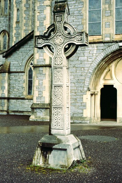
Foto: Holy Cross Church, Kenmare.
Uit de reisbeschrijving van Frames National, 1-8-1985:
Magnificently situated at the point where the River Roughty opens out into the estuary of the Kenmare River, the town has a fine setting among the Kerry hills. Kenmare was founded in 1670 by Sir William Petty on land assigned to him by the English government and colonised by a handful of Englishmen. With swords practically always in hand to withstand continuous assault, they built up an important fishery and established ironworks. The town is now a thriving agricultural centre, noted for its lacemaking, mostly done by the Convent of the Poor Clares. We stay for two nights at Kenmare Bay.
Days mileage 167
Uit de reisbeschrijving van Frames National, 2-8-1985:
Day 6 FRIDAY
A full day in Kenmare to relax or to take the opportunity to visit places of interest in and around the town in your own time. Among visits that may interest you are:
- Lacemaking in the Convent of the Poor Clares (off the Square). Point lace and many other varieties produced here have been world-famous for years, a display of lace can be seen at the convent daily 10am - 12 noon, 2 pm -4 pm and 7 pm -8 pm.
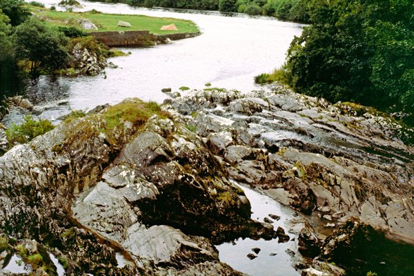
- Sheen Falls, two miles from Kenmare off the main Glengarrif road, or off the main Cork road.
- Dunkerron Castle, two miles west of the town on the Sneem road. The Castle dating from 1596, stands on a huge rock which was for centuries a stronghold of the O’Suilivans.
- Early Christian Church, one mile from town. This ruin, associated with Saint Finnan, is at Kenmare Old Church.
- Holyweil, ¾ mile from the town, off the main Kiilarney road.
- Druid’s Circle, ¾ mile south-west of the town, off Market Street.
- If you intend to do any walking in the area it is advisable to pack a stout pair of walking shoes and a warm lightweight jacket.
- Lacemaking in the Convent of the Poor Clares (off the Square). Point lace and many other varieties produced here have been world-famous for years, a display of lace can be seen at the convent daily 10am - 12 noon, 2 pm -4 pm and 7 pm -8 pm.
- Sheen Falls, two miles from Kenmare off the main Glengarrif road, or off the main Cork road.
- Dunkerron Castle, two miles west of the town on the Sneem road. The Castle dating from 1596, stands on a huge rock which was for centuries a stronghold of the O’Suilivans.
- Early Christian Church, one mile from town. This ruin, associated with Saint Finnan, is at Kenmare Old Church.
- Holyweil, ¾ mile from the town, off the main Kiilarney road.
- Druid’s Circle, ¾ mile south-west of the town, off Market Street.
- If you intend to do any walking in the area it is advisable to pack a stout pair of walking shoes and a warm lightweight jacket.
volgende: Kenmare-Kilkenny